
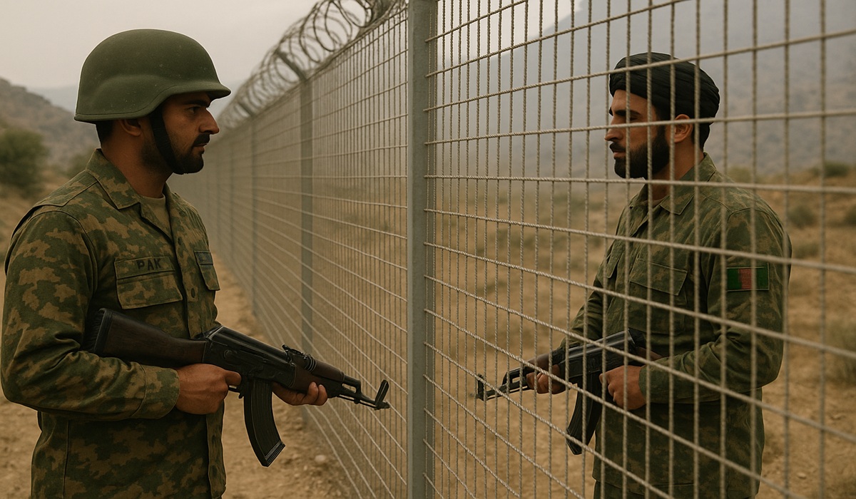
Colonial Lines, Enduring Wars: How France’s Borders Sparked the Thailand-Cambodia Conflict
- Naomi Dela Cruz
- East Asia
- Trending News
- July 30, 2025
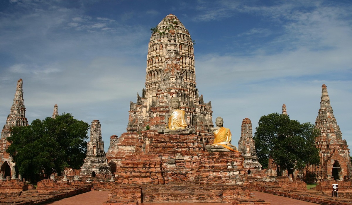
Image Credit: Wiki-images
France’s role in the territorial disputes between Thailand and Cambodia is a stark and enduring legacy of colonial interference in Southeast Asia. At the heart of the tensions is a border drawn not by either nation, but by French colonial authorities over a century ago. That border—still standing today—continues to provoke conflict, nationalistic fervor, and armed standoffs, particularly around the ancient Preah Vihear Temple. This conflict is not an anomaly, but rather a clear reflection of how European imperial powers, in their pursuit of control and expansion, imposed artificial boundaries that outlived their empires and fractured the regions they once ruled.
France entered Southeast Asia in the mid-19th century with the usual pretexts of missionary protection and economic opportunity, but quickly moved to consolidate territorial power. By 1863, it had established a protectorate over Cambodia, a weakened kingdom long under pressure from its larger neighbors, Siam (now Thailand) and Vietnam. Cambodia, the remnant of the once-mighty Khmer Empire, found itself increasingly unable to resist foreign encroachments. Seeking survival, Cambodian monarchs turned to the French for protection—though what followed was less a shield than a reshaping of sovereignty.
In 1867, Siam recognized France’s authority over Cambodia in exchange for keeping key western provinces including Battambang and Siem Reap—territories with deep historical and cultural significance to the Khmer people. These areas, home to the famed Angkor Wat and other remnants of the Khmer Empire, represented not just land, but legacy. For the French, such distinctions were irrelevant. Their interest was control—over people, trade, resources, and regional influence.
By the early 20th century, France’s appetite for territorial consolidation grew. Through pressure and diplomacy, it secured treaties in 1904 and 1907 that forced Siam to return Battambang, Siem Reap, and other provinces to Cambodia. But these adjustments, framed as diplomatic victories, were conducted with colonial cartographers at the helm. French surveyors—often unfamiliar with the geography, history, or significance of the lands they were mapping—drew borders that ignored ancient lines of demarcation, accessibility, and indigenous understandings of territory.
It was in this context that the Preah Vihear Temple became a permanent fault line. Built during the height of the Khmer Empire, perched atop a cliff in the Dângrêk Mountains, the temple was—and remains—a profound symbol of Khmer heritage. But due to the way France mapped the border between Cambodia and Siam, Preah Vihear was placed just on the Cambodian side of the line, despite being physically accessible only from the Thai side. It was a textbook example of colonial decision-making divorced from local geography and reality.
Following France’s withdrawal from Indochina in the 1950s, Thailand moved to occupy Preah Vihear, asserting practical control over the site. Cambodia, newly independent, protested, and the matter escalated to the International Court of Justice. In 1962, the ICJ ruled in Cambodia’s favor, citing the French-drawn map, which Thailand had tacitly accepted for decades. Thailand complied with the ruling, but the issue did not end there. Nationalist sentiments, cultural pride, and a sense of historical grievance have kept the border region tense for decades, erupting in occasional violence and diplomatic standoffs—especially after the temple was declared a UNESCO World Heritage Site in 2008.
This conflict is not about a single temple. It is about what happens when the remnants of colonial borders are left to determine the fate of modern nations. In Thailand and Cambodia, like so many post-colonial states, national identities were partially forged through reclaiming or defending what had been lost to empires—both ancient and European. The French decision to draw lines across this contested region without consideration for historical context did not simply redraw maps. It redefined memory, identity, and sovereignty. Two peoples with overlapping histories were forced into rival narratives, each asserting legitimacy over lands and monuments their ancestors once shared.
France’s colonial involvement in Southeast Asia is part of a much broader pattern. Across Africa, the Middle East, and South Asia, European powers carved territories to suit their imperial interests, rarely considering the long-term consequences. Where they saw administrative zones, locals saw kingdoms, family lands, spiritual centers, and ethnic homelands. The result, in many cases, has been generations of conflict, unresolved grievances, and borders that serve as scars more than lines of peace.
What persists today along the Thailand-Cambodia border is not just a disagreement over history or a religious monument. It is a colonial wound, reopened with every skirmish, every protest, and every declaration of cultural ownership. France may be gone, but its decisions linger in the soil, in the maps, and in the minds of those still fighting to define where one nation ends and another begins. This is not merely a case of disputed territory—it is the legacy of a foreign hand that never had the right to draw the lines it did, and whose ink never truly dried.


